
timeline: 3 days (2 nights)
distance traveled: 46 kilometers
elevation change: 1,329 meters
maximum elevation: 1,629 meters
itinerary: Blue Pools -> Young River Mouth -> Young Hut -> Gillespie Pass -> Siberia Hut -> Wilkin River confluence -> jet boat to Makarora
the crew: Sonny Falco and Johannes Mosig
I went on my fourth New Zealand tramp January 13th-15th in Mount Aspiring National Park. The track is called the Gillespie Pass Circuit which included some beautiful, but challenging, terrain.

Mount Aspiring National Park is in the South central part of the South Island of New Zealand, in the West Coast Region. The park was the 10th created, established in 1964. It also contains the Matukitui Valley, Routburn, and Rees-Dart tracks.
The track begins North of Makarora, heads south along the Makarora River, follows the Young River up into the Young Valley, ascends the ridge and passes through Gillepie pass, descends into the Siberia Valley following the Siberia River, and then heads into the Wilkens Valley. From there you can either hike back into town or catch a boat ride back.
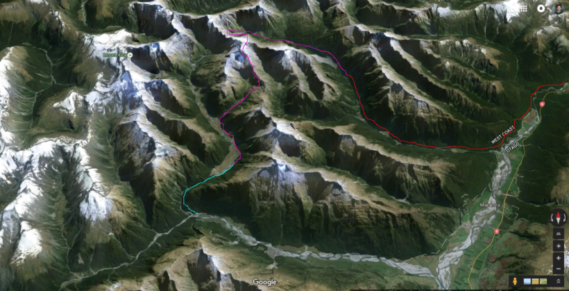
The route of the Gillespie Pass Circuit. Day 1 is in red. Day 2 is in purple. Day 3 is in blue. Due to weather contraints we were unable to visit Lake Crucible, and took a jet boat back to town a day early.
Day 1 (red): We started at the Blue Pools scenic area, just North of Makarora , where the track is adjacent to sheep/cow farms and has mostly open grasslands with lots of invasive species. Once you get close to the Young Valley entrance the vegetation shifts to silver beech [Nothofagus menziesii] forest. Elevation is slowly gained as you travel to Young Hut. Sun was out all day.

The legendary Blue Pools. The blue color is created by “glacial flour” in the water. These minute rock particles are created by the grinding action of glaciers against rock, and reflect light while they are suspended in the water.
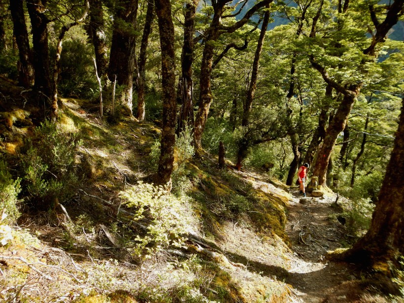
Day 2 (purple): The day begins heading further up the Young Valley. Elevation is more quickly gained here and the vegetation quickly shifts to subalpine with Hebes, small tussocks, daisies, and buttercups abounding. The track takes a steep incline as it heads up the East face of Mount Awful and up to Gillespie Pass. The top is truly alpine with mat plants and lichen throughout. From the Pass there is a great view of the surrounding mountainscape. The descent has a much lower grade and passes through another subalpine zone with more Chinochloa, Dracophyllum, and Aciphylla. The final leg of the long day is walking though an open grass meadow along Siberia River to Siberia Hut. Mostly sunny with some clouds during the early afternoon.

The view from the pass wasn’t too bad.
Day 3 (blue): An easy day from Siberia Hut to the jet boat pick up area begins with more open meadow. Soon though, you are back in the silver beech forest until you reach the Siberia-Makoroa River confluence. We got picked up by a jet boat from there back into town. RAIN.
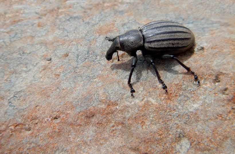
A wild weevile [Curculionidae] was spotted. The beetles mouth is located at the end of the snout, which it uses to bore into the seeds, wood, stems, roots, or leaves of plants that it eats.
All in all, the track has awesome mountain views, cool vegetation, and a good cardio workout to offer and I highly recommend it. However, the track can be treacherous especially under poor weather conditions and thus earns the “Experienced Trampers Only” categorization from the Department of Conservation for a reason. Choose a few days with nice weather for this one.

German on the ridge line.
Norwegian in the natural habitat.
See you on the trails,
-GTN

January 21, 2016 at 2:28 am
What a view! Great landscape shots
LikeLiked by 1 person
January 21, 2016 at 2:40 am
Thank you! I’m still leaning but will keep trying to get good ones.
LikeLike
January 21, 2016 at 2:38 am
Thanks for the detailed overview of the tramp. Glad to hear you had decent weather for most of the trip.
LikeLiked by 2 people
January 21, 2016 at 2:42 am
Thanks dad! I will likely be doing something similar for the Milford trip soon. I can use these posts towards a Communicating Science Certificate if they contain information about biology/ecology/botany.
LikeLike
January 21, 2016 at 9:42 am
Great post and brilliant photos. Looks like a serious trek. Good job you had decent weather too. We would have loved to have done a similar walk as part of our JWalking road trip (https://jwalkingin.wordpress.com/) but age and time just caught up (excuses eh). Good article.
LikeLiked by 1 person
January 21, 2016 at 7:10 pm
You’re only as old as you feel! And, it looks like you and Joan found the perfect way to stay active. There are many walks in the “East” Department of Conservation, but it looks like you did take the time to check some out. The landscapes are one of New Zealand’s highlights. Looking forward to seeing where you’ll be JWalking next.
LikeLiked by 1 person
January 22, 2016 at 12:34 am
Thanks, Greg. That was interesting. I’m not up for that kind of a trek though.
LikeLiked by 1 person
January 22, 2016 at 12:59 am
No worries Mike! We can do some easy ones.
LikeLike