ecolonaught

Chronicles of a 21st century naturalist.


7 Comments

The Milford Sound Track

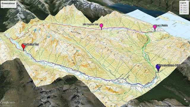
timeline: 4 days (3 nights)

distance traveled: 53.5 kilometers

elevation change: 950 meters

maximum elevation: 1,154 meters

itinerary: car park at Te Anau Downs -> catamaran ride to Glade Warf -> Clinton Hut -> wetland board walk -> Mintaro Hut -> McKinnon Pass -> Dumpling Hut -> Sand Fly Point -> boat to Milford Sound visitor’s center

the crew: Tom Nelson and Sarah Nelson

milford sound

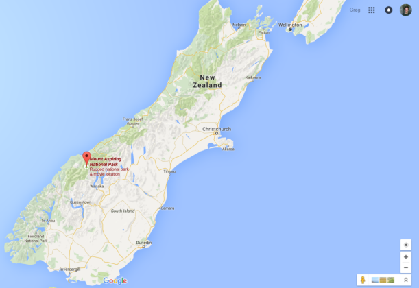
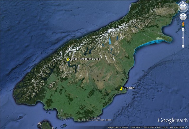
Fiordland National Park is located in Southland, on the south west coast of the South Island. It is the largest of the national parks at 12,500m^2. It’s name derives from a number of deep fiords that were carved out by glaciers in past ice ages.

Located in Fiordland National Park, the Milford Sound Track has much to offer. From New Zealand’s largest water fall to snow dusted alpine cairns, there is a reason it is the countries most popular track. My father and sister came down for a 22 day visit and this was the final stop on the itinerary (I wanted to make sure they would sleep well on the plane). In the end we agreed this was the most physically demanding thing any of us had done. We where happy to have gone through it together.

milford sound 2

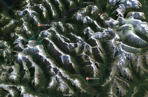
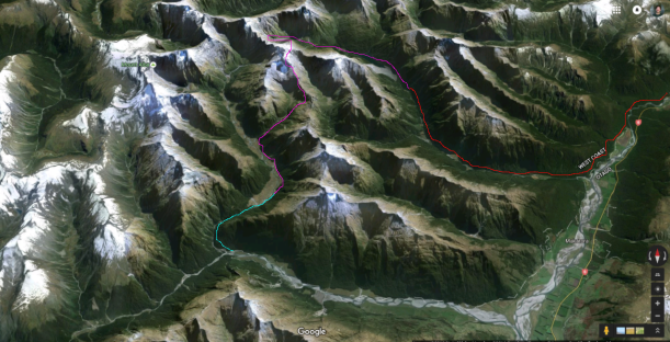
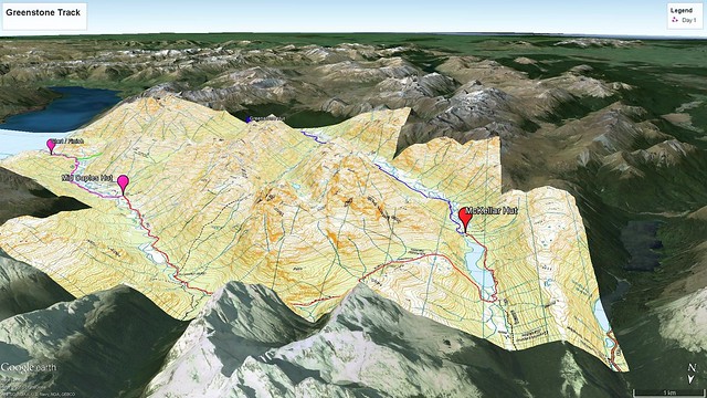
Overview of the trip. Day 1 is shown in red (5 km). Day 2 is shown in yellow (16.5 km). Day 3 is shown in turquoise (14 km). Day 4 is shown in purple (18 km).

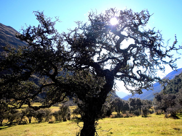
The first day consisted of a short boat ride and a short walk. As the boat approached the beginning of the track on Lake Te Anau we were able to get some great views of the rocky hills shrouded in mist. We were happy to see anything as Fiordland is notorious for it’s rainfall – more than 200 days a year with 6,800 mm annually on average. Once we reached the track it was a short walk  through beech forest to the Clinton Hut. On the way we stopped to check out a bog board walk that had some cool plants. The weather was great – almost no rain.

DSCN1332

The view from the boat on Lake Te Anau as we approached the trail head. Fiordland is overcast 2 out of every 3 days on average. This climate is driven by predominantly south westerly winds blowing up from Antarctica. The ocean air is moist, and as it rises over the mountains it loses density subsequently dropping it’s moisture on the land below.

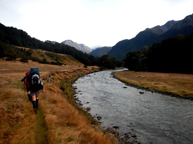
The second day is decent length with a slight incline, all the while following the Clinton River up its course. The track begins in beech forest, and shifts towards more scrub as you gain elevation. As you head deeper into the valley the rock faces rise high around you, providing some much needed existential perspective and many waterfalls. Mintaro Hut is located at the head of the river, and has a porch overlooking the surrounding mountains peaks. Again we got lucky with only light showers.

DSC_1203

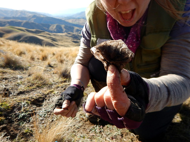
Ferns (pteridophytes) are an ancient group of plants thought to have originated during the Devonian Period of the Paleozoic Era 360 million years ago. Their vascular tissue set them apart from the plants that came before them, and reproduction through spores and frond leaf architecture set them apart from plants that came after.

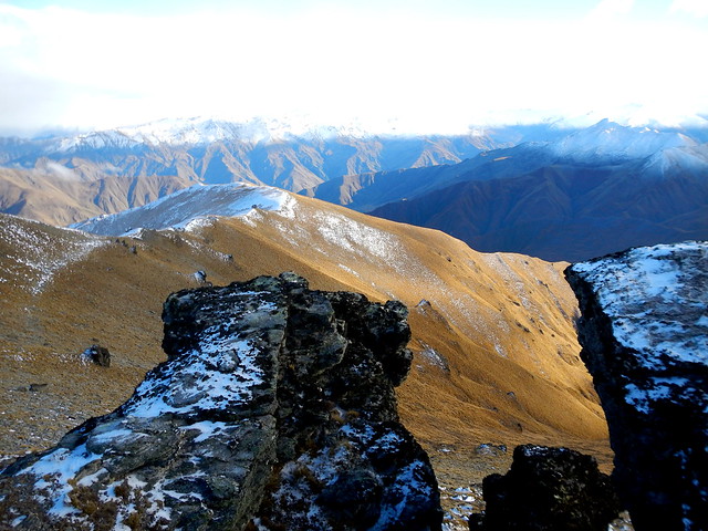
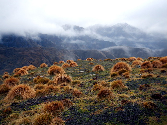
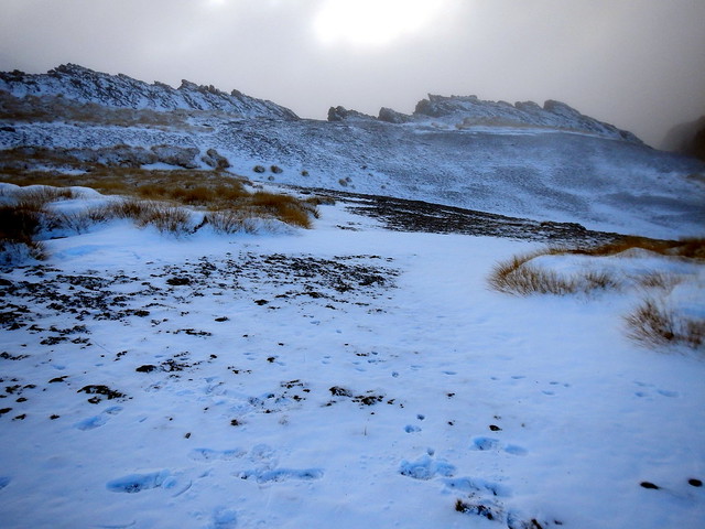
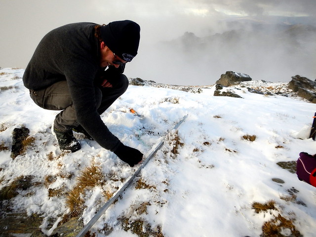
The third day was the most arduous. Although short in distance, this is the day you must hike up and over McKinnon Pass. The track starts with a great deal of switch backs, with the vegetation shifting to subalpine with numerous buttercups and daisies. It started snowing as we approached the top, and the snow covered flowers and grass fields provided some unexpectedly beautiful white scenes as we were buffeted by wind. At the top we stopped for a much needed break and some hot coffee. The decent was not any easier – it was steeper as well as wet and slippery. There is a side track that takes you to see Sutherland Falls, the highest waterfall in New Zealand. Once we made it down the rest of the walk is nice and flat until you reach Dumpling Hut. With some snow and wind on top of the pass and some showers as we descended we had a decent day for tramping.

DSCN1403

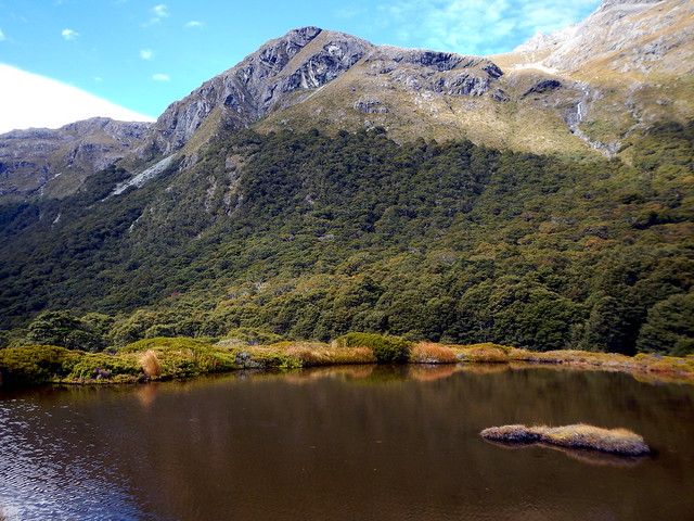
A snow dusted cairn near the McKinnon Pass. These ponds occupy amphitheater shaped depressions once occupied by glaciers. The large ice mass sculpted and depressed the hard granite, which now holds the water like a large rock bowl.

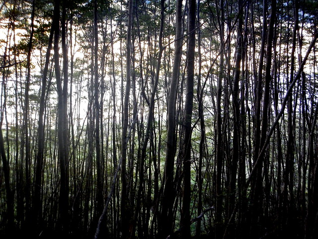
The final day is a nice flat hike out to the boat pick up location. The track follows the Arthur River down the valley through more beech forest. The trail cuts through some cool rock passages, has a few bridges, and some real cool boardwalks. Only on the final day did we feel the true power of Fiordland precipitation. With heavy rain starting early in the morning, we were soaked through before tea time. However, the water added greatly to the experience. The valley walls were littered with waterfalls – literally too many to count. I had a hard time seeing them through my glasses, but it was worth it.

DSCN1411

So many waterfalls!

We were happy to get inside and warm up/dry off after the trip. Once in Te Anau we went straight to a cafe, had a big feed, and chugged some beer. After that, spontaneous road trip back to Dunners! Their flight home was the next day. Overall, the trip was a major success – the family bonded over the four days and we all came out super fit. It was also the first time I organized a trip by myself which was a good challenge. We are hoping to do another family expedition in the not too distant future!

DSCN1419

Midwest family getting damp in the NZ bush.

Milford Sound Track is New Zealand’s most popular great walk for a good reason. The scenery, vegetation, and experience are worth the effort and money. It is of moderate difficulty so anyone who has been on a few other tracks should have no problems with this one.


See you on the trails,

-GTN


8 Comments

Gillespie Pass Curcuit

timeline: 3 days (2 nights)

distance traveled: 46 kilometers

elevation change: 1,329 meters

maximum elevation: 1,629 meters

itinerary: Blue Pools -> Young River Mouth -> Young Hut -> Gillespie Pass -> Siberia Hut -> Wilkin River confluence -> jet boat to Makarora

the crew: Sonny Falco and Johannes Mosig


I went on my fourth New Zealand tramp January 13th-15th in Mount Aspiring National Park. The track is called the Gillespie Pass Circuit which included some beautiful, but challenging, terrain.

mount aspiring national park

Mount Aspiring National Park is in the South central part of the South Island of  New Zealand, in the West Coast Region. The park was the 10th created, established in 1964. It also contains the Matukitui Valley, Routburn, and Rees-Dart tracks.


The track begins North of Makarora, heads south along the Makarora River, follows the Young River up into the Young Valley, ascends the ridge and passes through Gillepie pass, descends into the Siberia Valley following the Siberia River, and then heads into the Wilkens Valley. From there you can either hike back into town or catch a boat ride back.

Gillespie Pass Track

The route of the Gillespie Pass Circuit. Day 1 is in red. Day 2 is in purple. Day 3 is in blue. Due to weather contraints we were unable to visit Lake Crucible, and took a jet boat back to town a day early.


Day 1 (red): We started at the Blue Pools scenic area, just North of Makarora , where the track is adjacent to sheep/cow farms and has mostly open grasslands with lots of invasive species. Once you get close to the Young Valley entrance the vegetation shifts to silver beech [Nothofagus menziesii] forest. Elevation is slowly gained as you travel to Young Hut. Sun was out all day.

DSC_0017

The legendary Blue Pools. The blue color is created by “glacial flour” in the water. These minute rock particles are created by the grinding action of glaciers against rock, and reflect light while they are suspended in the water.


Day 2 (purple): The day begins heading further up the Young Valley. Elevation is more quickly gained here and the vegetation quickly shifts to subalpine with Hebes, small tussocks, daisies, and buttercups abounding. The track takes a steep incline as it heads up the East face of Mount Awful and up to Gillespie Pass. The top is truly alpine with mat plants and lichen throughout. From the Pass there is a great view of the surrounding mountainscape. The descent has a much lower grade and passes through another subalpine zone with more Chinochloa, Dracophyllum, and Aciphylla. The final leg of the long day is walking though an open grass meadow along Siberia River to Siberia Hut. Mostly sunny with some clouds during the early afternoon.

DSC_0116

The view from the pass wasn’t too bad.


Day 3 (blue): An easy day from Siberia Hut to the jet boat pick up area begins with more open meadow. Soon though, you are back in the silver beech forest until you reach the Siberia-Makoroa River confluence. We got picked up by a jet boat from there back into town. RAIN.

DSCN1451

A wild weevile [Curculionidae] was spotted. The beetles mouth is located at the end of the snout, which it uses to bore into the seeds, wood, stems, roots, or leaves of plants that it eats.

All in all, the track has awesome mountain views, cool vegetation, and a good cardio workout to offer and I highly recommend it. However, the track can be treacherous especially under poor weather conditions and thus earns the “Experienced Trampers Only” categorization from the Department of Conservation for a reason. Choose a few days with nice weather for this one.


DSCN1479

German on the ridge line.

DSCN1486

Norwegian in the natural habitat.

See you on the trails,

-GTN


4 Comments

no range for old men

Wow… it has been a long time since I’ve posted anything. There were some good reasons for this, but I’ll save that discussion for a dedicated post. For now let’s just revel in some beautiful alpine scenery.

On Saturday, December 19th the Botanical Society of Otago had a joint field trip with some other conservation organizations to the Old Man Range in the Central Otago region. The weather was nothing short of spectacular – all sunshine all day. There were many cool plants, insects, geology, and science discussed while we explored the area.

DSC_0087

The caravan during our lunch break. Some people used the down time to feed their plant photography hunger.

Professor Emeritus Sir Alan Mark was along for the trip as our naturalist guide. He provided a number of interesting stories, as he has been conducting field research on the range for many years. The oldest field experiment in New Zealand is an introduced snow bank treatment using a snow bank fence. The fence creates a drift area, so a snow bank is present behind it long after the spring sun has melted the surrounding cover. The snow cover creates different environmental conditions, which result in a different plant community beneath it. This suggests that there are a group a species specially adapted to snow bank creating areas, though the exact environmental factors and associated plant traits that involved in this are unknown as I understand.

DSC_0047.JPG

The old man (blue hat) and his snow bank fence. The snow piles up on the right side, changes the environmental conditions there and thus supports a distinct plant community.

Another interesting example of environmental conditions affecting plant community structure was observed at a site where 60 sheep died due to an extreme weather event ~80 years ago. Much of their skeletons are still present at the site, but that is not the only legacy they have left. Soil analyses have demonstrated that soil nitrogen and phosphorus concentrations are higher where the sheep died than in surrounding areas. This is because the nutrients from the sheep leeched into the soil and have since been stored in the soil microbial community or in the plants that have soaked them up. These altered soil conditions have also created a distinct high fertility plant community, with plants that have higher nutrient content  and faster growth rates replacing the typical residents. I didn’t get any cool photos of this one, though I’ll see if I can borrow one.

DSC_0139.JPG

Cool alpine plant placeholder picture.

Historic indicators of the last glaciation event are evident in the Old Man Range in the forms of massive deposited boulders, glacially etched chasms, and sculpted topography. But ice still works to shape the landscape. Depicted is a field of hummocks, or little soil mounds, that have formed naturally  through the freeze-thaw cycle. Measurements show that the hill tops, which freeze through during winter, are on average colder than the hollows, which are insulated with snow pack and do not freeze completely. This temperature difference, oscillating through summer and winter conditions, creates a soil wave action effect which drives the shape and movement of the hummocks like waves through water but on a much longer time scale. The hummocks also create microclimate conditions similar to the snowbanks. This seems to drive differences in the hollow vs. hill top plant species present.

DSC_0267.JPG

The hummocks, or soil “waves”. Their depth ranges from  around 0.2 – 0.6 m which is enough to create different microclimates within the hollows and hill tops.

We spotted many insects enjoying the summer feast of plants. There were mostly grasshoppers and beetles, but also arachnids like mites and spiders.

DSC_0129.JPG

A scarb beetle walking over a mat of moss in an apline bog habitat.

All in all it was a great day to be outside with cool people.

DSC_0061

The famous obelisk. How was it formed?


Happy holidays and all the best in the new year. I hope it’s filled with adventure, intrigue, and everything else you are keen on.

-GTN


4 Comments

brewing up good science

One of the great things about being co-supervised by people at Landcare Research is that I get to engage to top notch scientists, ask them about their research, and sometimes help them in the field!

From May 8th – 10th I was able to lend a hand to Barbara Anderson and her Master’s student Rob with their field work at Mt. Cardrona.

DSCN1113

The view from Mt Cardrona Summit. Fiordlands are seen snowcapped in the distance.

Rob’s research is on soil decomposition. When large organisms like trees and other plants die their organic matter become incorporated in to the soil. In areas with lots of vegetation the plant debris and litter that covers the ground is called the “O Horizon”. After awhile the plant material becomes partly decomposed and mixed with the next layer down, forming a nutrient rich environment called the “A layer”. It is here that most microbes reside and respire.

DSCN1122

Dead plant material gathering on the soil surface, forcing the litter layer. As particles decrease in size they are incorporated into the soil, forming the A horizon.

Understanding the metabolic action of these microbes is important because they are vital to nutrient cycles. They decompose previously living tissue and extract bound carbon, nitrogen, and other nutrients to be released into the environment once again so that other organisms may reuse these resources to grow.

DSCN1112

The snowy summit of Cardrona. Field work isn’t all fun and games!

Global soils store 3-4 times the amount of carbon than what is stored in global plant biomass. Therefore, understanding what, and how, factors influence soil nutrient cycling is paramount, especially in light of climate change. Two factors that are likely to have a major influence over soil microbial activity are temperature and humidity.

To elucidate the influence of these factors, Rob will be using the tea index across elevation and aspect gradients. The sites are positioned every 100m from the summit (~2000m) to the paddock (500m) spanning a ridge that has a sunny side and a shaded side. This range of elevation and ridge aspect encompasses a range of environmental conditions constrain microbial activity.

DSCN1117

Rob exhuming the first tea bag from the summit.

But how can we measure the metabolism of microscopic organisms on the top of a mountain? Cue the tea bag index. Microbes digest dead plant material. The rate at which they digest can be estimated by measuring the rate of weight loss in the dead plant material they eat. If we were able to develop a  unit of recoverable plant mass that could sit in ground for long times and have standardized weights, we could use these units to estimate soil decomposition rates across locations. This is what the tea bag index does.

Two flavors of tea are used – green and rooibos. Green tea is made of young leaves and roobios has mature leaves that are more lignified. The two break down at different rates, which allows Rob to estimate both the steep and shallow slope of the mass exponential decay function.

DSCN0481

Science is exciting!

By burying mass produced tea bags in the ground at different locations we can gain information about the factors that influence decomposition rates by comparing weight losses. There’s nothing better than science with a strong cup of tea! I’ll be following up this post with results when they are in.


3 Comments

Caples – Greenstone Loop

I finally had my first real life NZ tramping experience! It was awesome, and I hope there are many more to come. In this spirit, I have created a new post series titled “Track Trek” where I will be providing summaries of all my tramps [edit – new tag is just “Camping”]. For those of you not from New Zealand tramping is equivalent to hiking, not what you think it is.

My first tramp was on the Caples – Greenstone loop. It took 4 days (07-04-15 to 10-04-15) during which we traveled a total of 57.5 km (35.7 miles) with a 671 m (2,200 ft)vertical accent/descent. I went with two of my office mates and an Australian visitor.

Caples-Greenstone overall

The overall path taken for my trek. Dots represent huts where we spent the night and lines indicate paths traveled each day.

The track is located in the Fiordlands National Park, which is about a 4 hour drive from Dunedin, but well worth the trip. The park is located in a mountain range that spans most of the western coast of the southern island. This range is formed through subductive action of the Australian and Pacific tectonic plates, which New Zealand straddles. These mountains were then carved out by glaciers during the last ice age, which gives them their distinctive topographical features such as deep river basins and moraine wetlands.

Dunedin vs Fiordlands

The southern tip of Ne Zealand’s southern island. The two pins represent Dunedin, where I live, and the Caples-Greestone Track.

On the first day we meet up in the early morning, got a tall take away cuppa coffee, and started our journey with a short road trip. After pleasant drive through the scenic countryside, we hiked into the first hut at 8.4 km in. The Department of Conservation maintains many huts around New Zealand. The are minimalist trail houses with running water, wood burning stove, counter space for cooking, tables for eating, and bunks.

Caples-Greenstone day1

The trail taken the first day is indicated by the pink line. The trail starts on a field edge and gradually climbs up the valley wall into the beech forest.

DSCN0966

An example of one of the huts maintained by the Department of Conservation. For only NZ$15 this could be your home for the night.

On the second day we hiked 20.2 km as well as most of the vertical as we traveled to McKeller Hut from Mid-Caples Hut. Most of the hike was though beech forest, though there was a substantial area of alpine bog as we traversed McKeller Saddle. This was by far the most intense day of hiking and I was worn by the end of it. I also got some nice blisters.

Caples-Greenstone day2

The trail traveled the second day is indicated by the red line. This trail starts in the beech forests, which transitions into a podocarp – broad leaf mixed forest as you climb the mountain. The peak of the pass is an alpine bog, which turns back into beech forest during the steep decent and around the lakes.

DSCN0860

The top of the McKellar saddle (or mountain pass) at 996m above sea level. The area is dominated by alpine bog vegetation.

On the third day we hiked to Mid-Greestone Hut from McKellar hut, a total of 18.1 km. We had some stunning views as we walked past some lakes, and even managed to take a swim at the beach. Most of the hike was beech forest. We were able to see many green basalt rock formations from which the track gets its name. Those stones are precious to the native Maori culture and are often worn as ornaments.

Caples-Greenstone day3

The path traveled day 3 is indicated by the blue line. This trail starts as in the beech forest and opens up into field as you enter the valley bottom.

DSCN0810

The trail descends to the valley floor and follows the river down the valley.

On day four we traveled to the car park from Greenstone Hut (10.8 km). Most of this was in the valley basin where we were able to see many sheep and rivers. We also saw many fungi growing in the wet soil. It was an easy and relaxing final day to an awesome trip.

Caples-Greenstone day4

The trail taken day 4 is indicated by the green line. The trail follows the river.

DSCN0790

The native Matagouri tree in open field habitat.

DSCN0800

Native beech forest along the river banks.

In conclusion, my first tramp was rad as. It was one of the coolest things I’ve done since being in NZ and I can’t wait for the next one! Who wants to go with me?


7 Comments

Takahe Valley

My most recent field expedition was to Takahe Valley; a place with an interesting conservation narrative, beautiful scenery, and a fantastic place to do research.

I went to Takahe Valley March 7th – March 10th with along with two Landcare colleagues and another PhD student. Our purpose was to assist with end of the summer field data collection.

The  crew grabbing lunch.

The crew grabbing lunch.

Those of you well versed in your New Zealand native birds will recognize the name takahe (Porphyrio hochstetteri). The species was thought extinct when the last 4 known individuals were captured and killed in 1898. However, Geoffrey Orbell rediscovered a remnant population of the birds in a place isolated from human activities near Lake Te Anu (Takahe Valley) in 1948. Concerted conservation efforts since rediscovery have resulted in relatively successful recovery. The Fiordland National Park was created to ensure them a safe home, and deer control is carried out within the park to reduce competition for food. The wild population estimate as of 2013 is 263.

takahe

A takahe in captivity. Phtoto by New Zealand Department of Conservation (http://blog.doc.govt.nz/2014/12/01/takahe-finds-love-te-anau/)

I wasn’t able to see any of these beautiful birds (locally “blue chickens”), but I was able to see signs of their presence including well traveled tracks, digestive remains, freshly munched tussock grass, and tracks. Hopefully next time I will be able to sneak a peak!

I was able to see some other charismatic birds though including a Kea (Nestor notabilis), NZ rock wren (Xenicus gilviventris), rifleman (Acanthisitta chloris), and tomtit (Petroica macrocephala).

A Kea investigating our campsite, as well as me, to see if it can get an easy feed.

A Kea investigating our campsite, as well as me, to see if it can get an free feed.

The Fiordland foothills are composed of gneiss (metamorphosed from mostly granite and diorite). Apparently this is some of the oldest rock in NZ, originating from the Ordovocian period. The valleys and basins were etched through glacial erosion during the last ice age. Alpine areas have exposed rock or scree substrate, while basins soil is composed of podzolised gley and organic soils. The vegetation in our valley ranged from sub-alpine herbs up on the exposed rock and scree at the valley ridges to wetland species down in the basin. Beech forests and tussock grasses can be seen covering and deferentially partitioning large swaths of the valley.

The basin has a river flowing through it. This area is dominated by wetland vegetation.

The basin has a river flowing through it. This area is dominated by wetland vegetation.

Tussock grass vegetation dominates portions of the basin, as well as some portions of the lower and upper walls, of the valley. Forest dominates most of the midsection.

Tussock grass vegetation dominates portions of the basin, as well as some portions of the lower and upper walls, of the valley. Forest dominates most of the midsection.

campsite

We camped partially up the valley, at the head wall. This area has some tussocks but also some sub-alpine herbs due to the higher elevation and some wetland plants from the the head water flow.

valley ridge

The head wall ridge. This area has exposed rock and screes, mostly dominated by sub-alpine plants with some small tussocks.

The main purpose of our trip was research. There are transects of tussock grasses here that have been measured for over a decade, investigation the masting events of the tussocks (Chionochloa sp.). Masting is the phenomena of some plants to usually not produce many flowers/seeds most years, but every few years they will all create massive amounts of flowers/seeds. In North America most oak trees (Quercus sp.) display some level of masting.

A feather’s fate; only to drift on the low breeze; never to fly again

Another component of the research is to investigate the interacting influences of anticipated climate change, increasing soil N, and increasing soil C on tussock growth as well as reproduction. Climate change is simulated by putting translucent plastic around the bases of the tussock (creating a mini green house gas effect). Soil N is increased by adding fertilizer. Soil C is increased by sprinkling sugar on the plots. We had to count the number of tillers (stems) on every experimental plant (counts ranged from ~30 to ~800). The cages are to protect the tussocks from takahe, as this is their favorite food.

These are the experimental plots on the red tussock (C. rubra).

These are the experimental plots on the red tussock (C. rubra).

We also collected invertebrate data for each plot to see if the treatments (temperature * N * C) had an influence on invertebrate diversity or community composition.

Me emptying invertebrates from pitfall traps. These traps passively capture insects by trapping them in a cup filled with death liquid.

It was a fantastic trip filled with good company, good weather and goo food. I eagerly await my next expedition into Takahe Valley!

-Greg


Leave a comment

Recent developments

It has been way too long since my last post. My three new priorities for the year were (1) kick butt in my program (2) get more exercise & (3) write more blog posts. I’ve made some good progress on the first two, so now I’m on to the third.

A quick synopsis of my life since the last post:

– returned to the US for Christmas and New Year; enjoyed the company of my amazing friends and family

My sister in a stand of oaks, surrounded by native prairie.

My sister in a stand of oaks, surrounded by Wisconsin native prairie.

– visited my partner in NYC

JP

Tyrannosaurus rex skeleton at the American Museum of Natural History.

– attended a statistics course in Halifax

– returned to NZ, began seriously getting into research mode

– I was a teaching assistant for an undergraduate ecology field course in the Catlins

Me standing at the rocky shore edge of Curio Bay, in the Catlins.

Me standing at the rocky shore edge of Curio Bay, in the Catlins.

– assisted with some field work investigating the effects of land use and native vegetation herbivory

seeds?

Me checking to see if native seeds and seedlings survived mice and rat herbivory.

– assisted with field work investigating the effects of climate change on tussock ecosystems in fiordland

My colleges field research site, Takahe Valley in the fiordlands.

My colleague’s field research site, Takahe Valley in the fiordlands.

That gets you caught up on pretty much everything! More pictures and in depth analysis to come.

-GTN


Leave a comment

NZ Ecology Society Conference

My birthday was last week, and I had a great time! Although I don’t really have any insightful statements, I do have a lot of ecology to talk about. I celebrated by attending this year’s Ecology Conference at Massey University in Palmerston North. I was able to learn a great deal about New Zealand ecology by sitting in on some great talks as well as speaking with some inspiring scientists. I will be summarizing the highlights here.

I’ve always been fascinated by the trade-offs between sexual and asexual reproduction. Sexuality reaps the benefit of genetic diversity, but is a density dependent interaction (you need to be able to find a mate).  Being able to do a direct comparison is difficult because species usually can’t do both – but some do! Like the NZ snail. It reproduces sexually in a diploid state, but is able to switch to diploid (3 or 4 sets of chromosomes) as subsequently reproduces asexually. Laboratory experiments demonstrated the the asexual snails outperform sexual snails in every fitness metric (growth rate, strength, reproduction time, and reproductive output), but are only found in watersheds that are high in nutrients. This suggests that polyploidy is a competitive advantage if there are enough resources for extra sets of chromosomes but is unable to persist in low nutrient conditions, driving asexual populations locally extinct. Mechanisms related to how this with is made remain, but it is certainly a line of research worth continuing.

One research lab investigated the flammability of different types of plants by putting them in a grill! (with standardized procedures)

Through analysis of a wealth of extraordinarily preserved fossils and amber specimens it has been shown that although New Zealand’s contemporary insect communities are quite disparate, in the past a wealth of invertebrate diversity existed on the islands. These specimens date to before the last ice age, and so it is likely that changing climates and range reductions drove many of them extinct.

In an amazing demonstration of stabilizing selection pressure, it was demonstrated that a serious NZ invasive weed, gorse, has evolved larger seeds outside of its home range. In Europe it is paracitized by a beetle larvae, which feasts upon its seeds when young. It prefers larger seeds because they contain more food, thus when the beetle is present it exerts a pressure for smaller seed size. When the beetle is removed from the equation when gorse is transported to new territory that pressure is removed, seed sizes become larger over a few generations as larger seeds mean greater survivability in general. Neat!

I can’t wait to be presenting my own exciting findings next year!


1 Comment

Pine Tree Massacre

Hello! It has been awhile but I have had some exciting developments, and will highlight them here for you.

First off, I will be spending the next week and the NZ Ecological Society Conference in Palmerston North. There are many exciting talks on the schedule and I hope to be inspired to develop some new research ideas. I will outline my thoughts in my next post. I also have begun preparations for my first experiment! Once I get this set up I will provide an overview as well as some pictures.

This past weekend I went on a trip to Mid Dome, Southland on a wilding tree control exercise with the Wilding Tree Trust. Two species of pine tree (Pinus mugo & Pinus contorta) were introduced as erosion control species and have subsequently become aggressive invasive, domineering native grasslands and forests. In order to preserve native diversity the spread of these trees must be stopped. Their source population is relatively remote, so we had to fly in by helicopter! 10-11 IX10-11VIII

I, along with a number of conservation minded kiwis, set out to control their spread by uprooting and felling small trees. Sir Alan Mark, a famous NZ conservationist, joined us for the trip as he play an active role in managing the program.10-11 XIIIDSCN7722


Over the course of two days I personally killed over 100 trees. The combined efforts of the group proved formidable, as we completely cleared the faces of two foothills.


All in all, it was a great trip full of interesting people and amazing views. It felt great to contribute to my new natural surroundings and lend a hand in preserving what makes New Zealand such an amazing place. I plan on going future trips so hopefully more success stories will follow!10-11 X

Welcome to Dunedin!

4 Comments

Wow! It’s crazy to think that I’ve been in New Zealand for almost three weeks. Mostly I’ve been getting focused on my research project, which is well under way. But, I have been able to get out on a few adventures and I thought I should share the highlights so far.

My adviser’s wife is a geologist and archeologist. During my first week she invited me to go along on a fossil hunting trip with her post doc. Needless to say, living out one of my Jurassic Park inspired dreams was amazing. I’m not so familiar with geology, but from what I gathered we were digging in an old swamp/lake. The rock was damp, soft, and black from the high density of organic compounds. I was happy to split as many rocks as I could, because within each was the potential for a secret that lay in wait for millions of years waiting to be unleashed. I found many fossils of flowers and leaves, a few small fish skeletons, and one weevil. The weevil was very well preserved and I got some macroshots after the lab analysis. Though, my favorite part was cracking open a rock and sighting a perfectly preserved leaf – veins, cuticle, color and all – just before it was blown away in the wind, its atoms finally resurrected and free to spur life anew. I’ll be going digging again the soonest chance I get.

Weevile photos_page2_image3

The fossilized exoskeleton of a weavile. Notice the extended mouth part to the left, and appendages below.

Weevile photos_page2_image2

Fossilized exoskeleton of a weevil counter relief. Notice the mottling of the carapace.

View of the tussock grasslands of New Zealand.

View of the tussock grasslands of New Zealand.

On one nice afternoon I took a hike to one of the highest points around Dunedin, called Flagstaff (historically where a flag was raised to signify the arrival of a ship carrying supplies and visitors to the harbor).  The view and the hike were amazing. My legs joined my ears in getting a vivid appreciation of the elevation changes here. In attempts to improve my NZ naturalist skills I was able to check out many native birds and plants. Unfortunately there haven’t been many insects around yet, but I’m hopeful since summer is quickly approaching.

View of the city and harbor from Flagstaff.

View of the city and harbor from Flagstaff.

Other than that I’ve spent a lot of time at my desk reading and working on data sets. Now that I’ve settled into my own place I will be for sure be tramping about town more and taking pictures of my adventures.  The botanic garden is literally right in my backyard…

Be peaceful,

-Greg

This gallery contains 4 photos